Overview
Calytrix CSE / Core Features
Calytrix CSE is the first virtual environment that can realistically provide a Unifying Platform for existing simulation capabilities to interoperate in Air, Land, Sea and Space with Global Interoperability. This expands simulation beyond the traditional “Part Task Trainers” to cover everything from Modelling and Pre-Production Prototypes through to Experimentation, Test and Evaluation, with a wide gamut of training capability in-between.
The major innovations of Calytrix CSE include:
- A Global Battlefield
- Complete rendering of entire planet
- Procedural algorithm renders any resolution source data allowing low and high fidelity data to be used
- Air, land, sea and space in simultaneous operations worldwide
- Object fidelity measured in centimetres (15cm) not metres
- Real-Time Terrain Editing Tools
- Standard internal tools allow point & click laying of roads and buildings with foundations
- Real-time terrain deformation for cratering effects and terrain modifications
- Real-time placement of geospecific or geotypical buildings
- Open Design Philosophy
- Open User Interface — HTML5/CSS — including direct HMI rendering into Calytrix CSE
- Open development tools including native Javascript support, node.JS interfaces and a direct C++ API
- Open Entity Configuration, allowing users to modify characteristics of Vehicles and Weapons without returning to OEM
- Open standard model and terrain data formats
- Web Integration
- User Interface built on Google Chromium
- Display media and web pages and integrate web-apps directly in Calytrix CSE
- real-time social media feeds and maps (Google Maps, OSM, Tweeter, etc)
- Link to external device browsers via node.js
Summary of Calytrix CSE Features
Calytrix CSE supports the following general features:
Full global rendering with spherical world
- Unlimited terrain size
- Unlimited view distance
- Land, Atmosphere, Ocean, and Space environments on a global scale
- Seamlessly zoom out from blades of grass to outer Earth orbit and back again
- real-time traversing of entire planet
- Detail ranging from thousands of kilometers down to centimeters
- High fidelity atmospheric rendering (both visually and physically for aircraft & ballistics)
- Global time zones
Planet-wide Geospecific Dataset
- Publicly available 30m source data included, refined to 15cm detail
- Initially “unpopulated” without human structures but with trees, rocks, hills, cliffs, shores and natural features
- Current stage of development: automatically populate with road, river, etc vector data across entire world
- Next stage of development: automatically generate cities based on population data, building footprints and libraries of buildings and structures
- Fractal refinement mimicking natural processes (erosion, rocks, overhangs)
- Optional real-time streaming of terrain over internet (or local data files for seamless global span - entire planet is stored in just 48GB of data)
- real-time editing of terrain to add custom roads, buildings, etc
- real-time terrain deformation, including automated building foundations, road banks etc
- Google map overlays for terrain editing
- Open Source One World Server (OWS) to manage data and serve WFS maps
- Open Source ArcGIS plugin for high-end data manipulation
LVC Game Integration
Full LVC Game integration, including:
- Support for all major versions of DIS protocol
- Support for all major versions of HLA (1.3, 1516, 1516-evolved)
- Support for all major commercial HLA RTI vendors (Pitch, MaK, Raytheon)
- Support for the Portico open source RTI
- Support for all major HLA FOMs (RPR1, RPR2, JLCCTC ERF)
- Growing support for C2 protocols
- Automatic dead-reckoning of all incoming and outgoing traffic
- Advanced filtering to ensure your system can work in the largest constructive environments
- Data-offsets to micro-adjust types in non-correlated environments
- Built in monitoring and management tools to see what is happening on the network
CNR Sim Integration
Advanced CNR Sim integration, including:
- Advanced Radio Simulation
- Capture, Replay and After Action Review (AAR) Capabilities
- Communications Network Monitoring
- Physics Based Signal Degradation
- Full Development Interface
- Bidirectional Real to Virtual Radio Bridging
Terrain Packaging System
- Create terrain area packages
- Activate and Deactivate terrain packages on demand
- Easy distribution of terrain packages via email, thumbdrive, cloud storage services, etc…
3D Model Import Tool Within Engine
- Immediately configure and test new models
- Directly imports .fbx and Collada 3D models
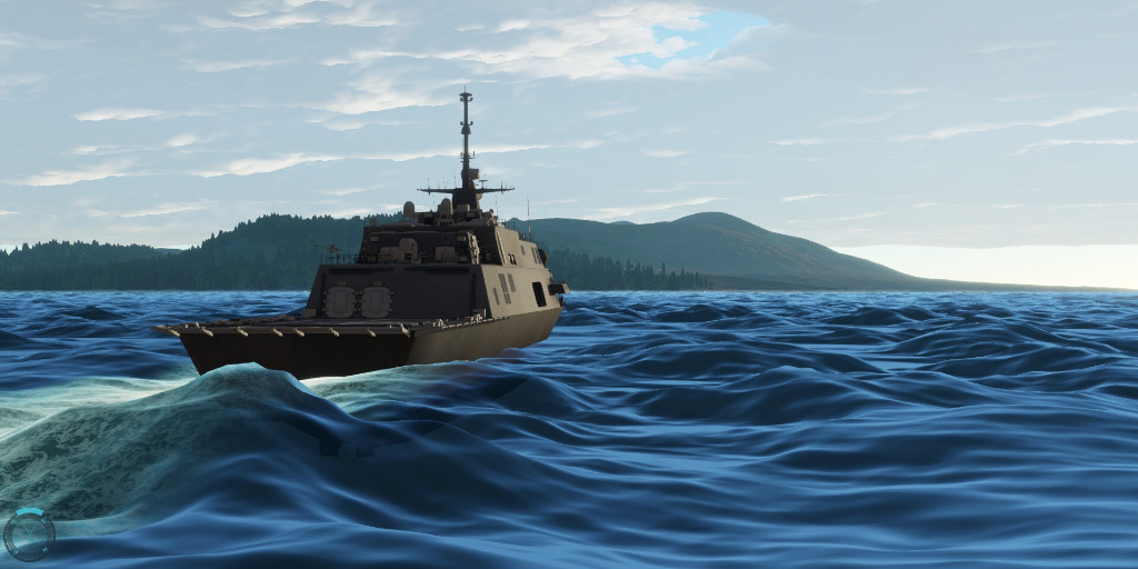
Land, Sea, Air and Space Entities
- Operate in any domain
- Open configuration files for users to define any entity they wish
Open Source Flight Dynamic Model Library
- JSBSim, as used in the popular open source flight sim, “Flight Gear”
- Customisable XML flight models for each aircraft
- Very high fidelity flight modelling for fixed wing and rotary
Open Source Physics Library
- Bullet Physics, as used in Grand Theft Auto V and many other AAA games
- Also used in many Hollywood movies for major effects work
Web Technology Integration
- Direct HTML 5 integration via embedded Chromium
- Internet or Intranet web interfaces directly within engine (display web pages, media and apps live within simulation)
- Web app/services integration such as collaborative documents within engine
- Open Source node.js interface to natively link to tablet devices, smartphones, etc
Media Integration
- Display common media formats through HTML UI
- Integrated RTSP video stream
JavaScript Scripting Interface
Free C++ API for plugin development
Fully Open Customizable GUI
- HTML and Javascript, fully exposed to customer
- Users can modify or replace any UI elements
- Full frontend replacement for custom simulations/apps
2D Map System
- Custom map layers (online or offline)
- Google Earth & OpenStreetMap synchronized viewer with translucent overlay over 3D terrain
Scenario Constructor/Admin
- Create scenarios in point & click GUI interface
- Waypoint system
- Trigger system
Scenario Lobby
- Multiplayer Networking
- Join in progress, client resume
- real-time multichannel setup during gameplay
Scenario Admin
- Modify scenarios in real-time during gameplay
- Take control of any entity at any time
Scenario Debrief
- Playback from any viewpoint or entity
- Fast forward/rewind/skip and other controls
- Overlays and entity/weapon trails
In-game Recording
- Video and Sound
- Screen Image Snapshot
Global Weather System
- Cloud and fog settings
- Expanding to rain, snow, etc
- Potential to link to current, historical and forecast weather database
- Set rate and characteristics of sun and light
- Set global sea level - simulate effects of global warming
- Sea State support (initial prototype)
Modern System Architecture
- Fully asynchronous multi-threaded design to utilise all available CPU and GPU cores
- Terrain and graphical rendering running 100% on the GPU for maximum efficiency and ease of hardware upgrade
Extensible AI architecture
- Designed by the Lead AI Engineer of the Assassin’s Creed game series.
Advanced Animation System
- NaturalMotion Morpheme, as used in GTA 4/5 and other AAA Games
- Full toolkit available for users to make/import own animations